Take a Walk


Drayton to Langport Walk
- Easy going.
- Dry now, parts do get muddy, specially through the trees at Ash Wood and off Frog Lane.
- About 3.5 miles
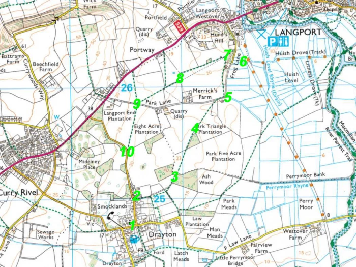
However you get there from Curry Rivel, start your walk by the St Catherine's Church (or the pub!) in Drayton – #1.
The blue lias and golden hamstone church dates from the 15th century and has been designated a Grade I listed building. In fact, standing at the junction of Church Street, North Street and East Street, you are surrounded by historic listed properties.
On leaving the church, cross over Church Street to The Drayton Crown (early 19thc), across its car park entrance you'll find the thatched Duck Cottage (15th/16thc), then imposing Brick House (late 18thc) and The Old Beams (15th & 17th c). Cross back over the road (now East Street) to the pretty wisteria clad Palfreys (16th 17th & 19th c), opposite which stands the Drayton War Memorial, listed as being of historic interest as "an eloquent witness to the tragic impact of world events on the local community, and the sacrifice it made in the conflicts of the 20th century".
Drayton is one of the few villages in the UK that still practice wassailing, not to be confused with orchard wassailing, this annual event is held on the 5th January and involves the wassailers visiting a handful of village homes before ending at the Drayton Crown.
If ever an excuse were needed!
But let's get on with this walk.
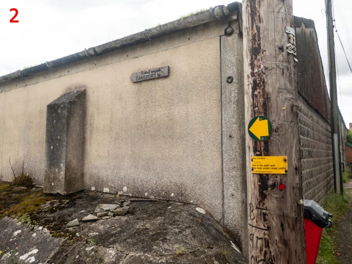
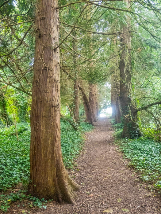
Leave your history at the junction and head up North Street to the track on the right after Northover Farm, signposted to Langport – #2. The grass path leads to a gate, cross the field to the stile and onto a shaded path through Ash Wood – #3.
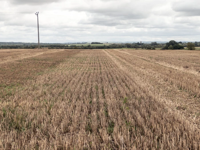
Emerging from the wood onto Park Five Acre Plantation, presently harvested and with the path clearly visible through the middle towards the woodland at Park Triangle Plantation, on a clear day you can look to your right beyond the church at Muchelney, to Long Sutton, Somerton – perhaps Kingsdon. It's hard to decide which spire is where. Whilst it might seem here you are at a high point, in reality you are a heady 23m above sea level whilst the land below you rarely pokes its head above 10m.
There isn't a stile to head for at the end of this field, just a gap in the hedge and a rudimentary wooden footbridge over the culvert, from where, keeping the woods to your right, the view opens up to the left and in front of you. Largely agricultural, but you can make out the properties down Sandpits Hill and, in front, the small group of dwellings at Merricks Farm.
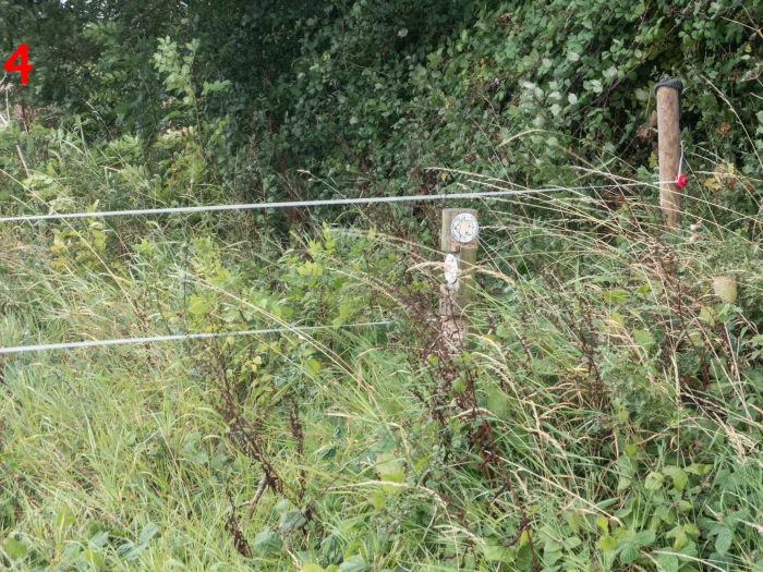
As you reach the end of the wood at #4, there's a reasonably well hidden marker post sending you down and across the field towards Langport. Don't follow the field margin, just plough on down as directed towards what once were lime kilns, there still being a building there known as the Lime Kiln. On the land to your left, across the lane from Merricks Farm, early 20th century maps identify the area as Park Quarry. Historical records suggest that there was quarrying and associated lime burning in this area from late the late Victorian era until well into the 1930s with a tramway running between the quarry and the kilns. Alas, it is not know when the rails were dismantled and little, if any, evidence now remains.
So you reach the stile onto Park Lane/Frog Lane corner at #5. Carry on down the lane towards Langport, following its turn to the left and on until you reach the turning right at #6 that takes you either onto Huish Drove track or the old railway line, each of which will get you into Langport for a cup of coffee and a cake at one of several cafes dotted along Westover, Bow Street, Cheapside and North Street.
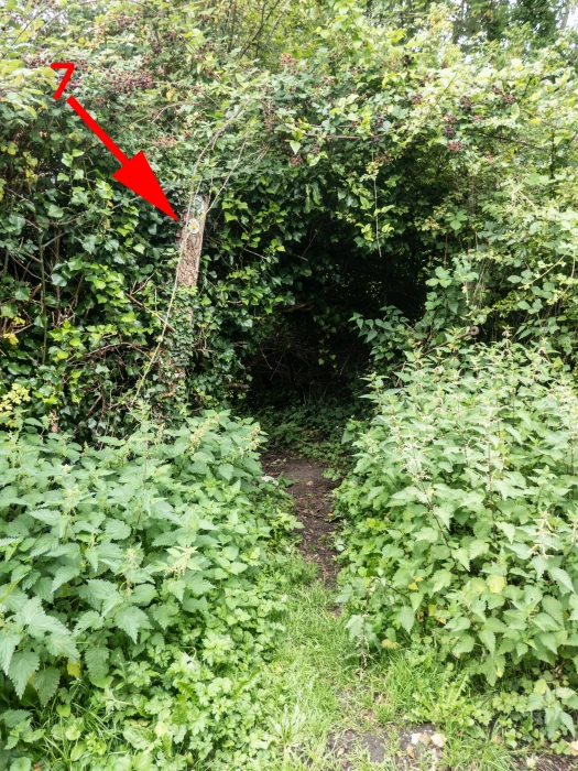
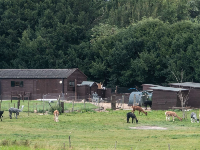
After your cuppa, or if you've just marched on, you need to find that illusive footpath on the left at #7 which takes you up through the trees and over the back of Hurds Hill, watching out to your right for the llama farmer and to the left looking towards the Park Triangle Plantation you've just walked alongside. On land to the right of the footpath between the path and the A378 once stood the St Mary Magdalene Leper Hospital, established in the 13th century, and later becoming an alms house. No traces of any building can be seen.
The new building now erected on part of the land has been named Old Alms House Barn. Perhaps some research went into that then – well done!
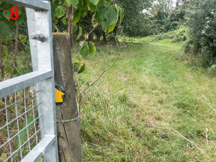
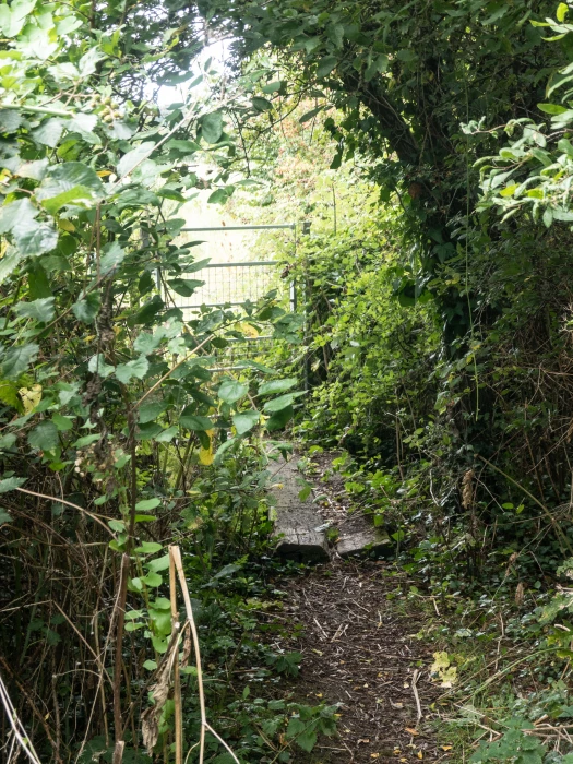
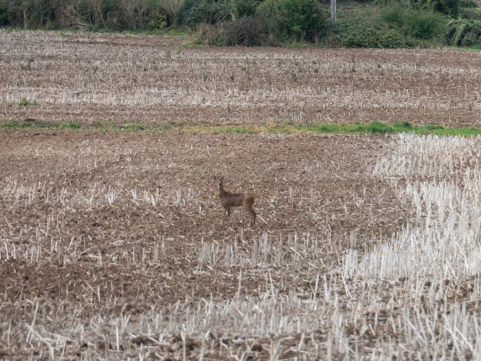
A sign on the gate ahead of you at #8 directs to towards a second gate hidden in the hedge onto the footpath which, two gates later after crossing the 'big field' on Sandpits Hill (where it wouldn't be unusual to spot a deer or two) takes you to a couple of stiles that cross Park Lane marked as #9.
Walking the path between Langport End and Eight Acre Plantations brings you out part way up North Street at #10. Here you head home whichever way you choose to Curry Rivel – either up North Street to the corner of Midelney Place, or back down towards the church where you started. Or the Drayton Crown.
Well it'd be rude not to investigate the reason for its listing wouldn't it?
Click any image to enlarge.
Read more about listed properties in Drayton at Historic England's website historicengland.org.uk/listing/the-list/.
More historical records at somersetheritage.org.uk
And dont forget readers, send me details of your favourite walks in and around Curry Rivel. Info – with or without photos – to editor@curryrivel.org.uk.
Get In Touch
CurryRivelOnline is powered by our active community.
Please send us your news and views.
Email: editor@curryrivel.org.uk